-
(818) 833-8737
13521 Hubbard St.Sylmar, CA 91342
- Login
Lost Hiker Rescued Above Veterans Park
Posted on 01/07/2026
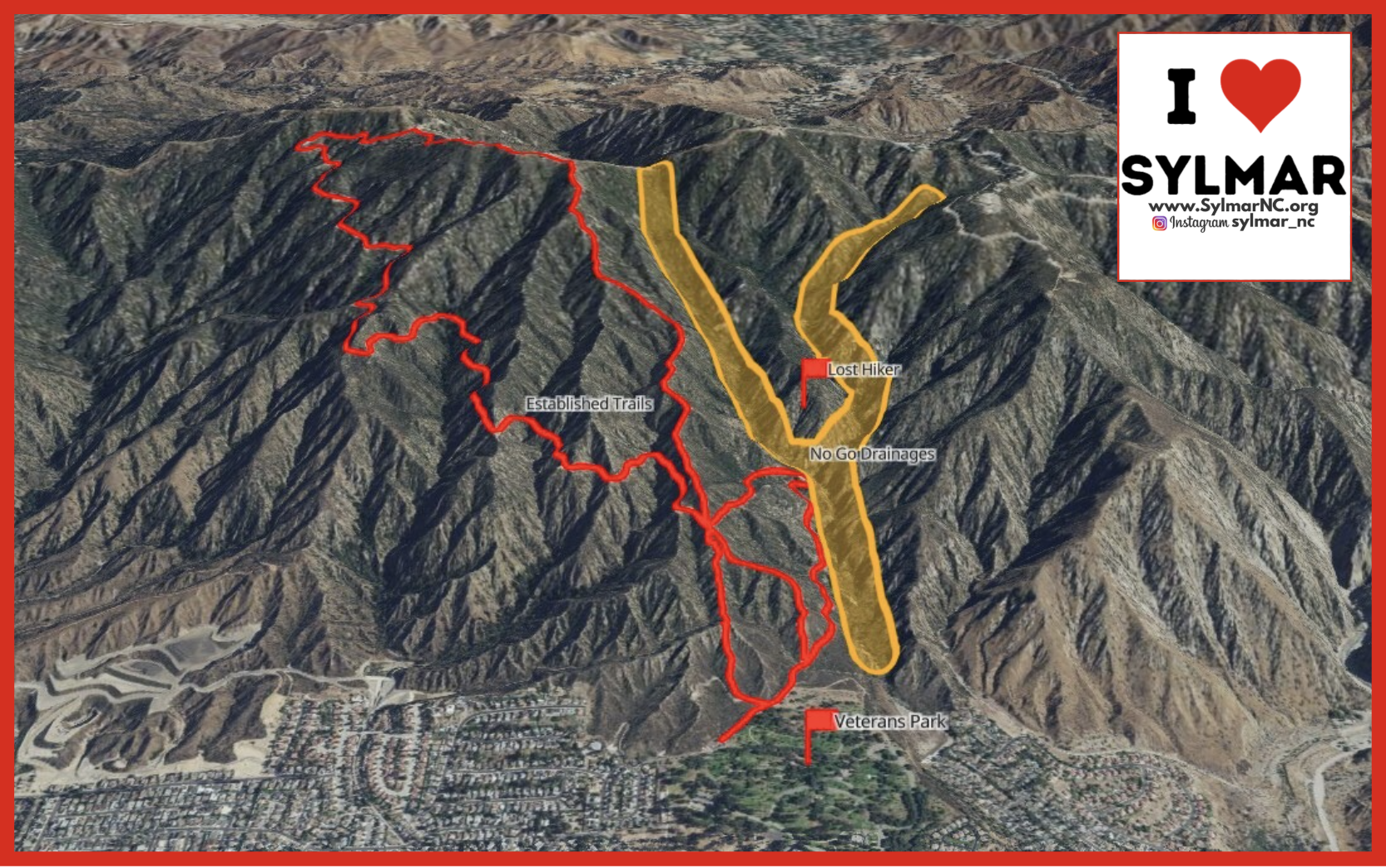
Lost Hiker Rescued Above Veterans Park
Message is from Montrose Search & Rescue
At approximately 6:17 PM last night, we responded to a report of a lost hiker above Veterans Park. The hiker had gone off trail and became lost in the dark. He eventually found himself stranded on a ridgeline surrounded by steep cliffs, in rugged terrain with no safe or practical access on foot for rescuers.
Due to the dangerous location and lack of ground access, Los Angeles County Fire Department Copter 19 was requested. The hiker was safely rescued via hoist, after which our team met with him and assisted with transport off the mountain. Fortunately, the hiker was not injured, but the situation could have ended very differently.
We want to use this rescue as an opportunity to share important preventative safety guidance.
Over the past several months, Montrose Search and Rescue has seen a noticeable increase in calls originating from the mountains above Veterans Park. Many hikers begin their trips at the park and head north into the surrounding terrain. At some point, they lose the established trail and unintentionally transition onto game trails or drainage routes. These paths may look passable at first but often lead into steep, loose, and unstable terrain.
The ground in this area is especially prone to crumbling beneath your feet.
During a recent rescue in this same canyon, the ground gave way beneath one of our rescuers, highlighting just how hazardous these slopes can be, even for experienced personnel with specialized equipment.
To help prevent rescues and injuries, we strongly encourage hikers to follow these safety tips when recreating in the mountains above Veterans Park:
- Stay on established trails at all times.
- If a path becomes faint, narrow, or appears to drop steeply downhill, stop and reassess.
- Game trails are often misleading and do not lead to safe exits.
- Learn how to identify a game trail.
- Game trails tend to be narrow, uneven, and may abruptly disappear or descend into brush-filled or rocky areas. Established trails are wider, more consistent, and typically show signs of regular human use.
- Carry a fully charged phone and download offline maps before your hike.
- Cell service is unreliable in this area, and offline maps can help you confirm you are still on the correct trail.
- Bring a physical map or know your route in advance.
- Do not rely solely on memory or assumptions about where a trail “should” go.
- If you find yourself off trail, stop early.
- Continuing downhill or pushing forward often leads deeper into unsafe terrain. Early recognition can prevent a dangerous situation from escalating.
The mountains above Veterans Park are steep, unforgiving, and far more complex than they appear from below. Staying on trail and being prepared are the best ways to ensure a safe and enjoyable hike.
We are proud to serve our community, but we always prefer prevention over rescue. Please hike smart, stay on trail, and help us keep both hikers and rescuers safe.
Thank you to Copter 19 for your help last night!
Want information on local hiking in Sylmar? - https://www.sylmarneighborhoodcouncil.org/page/viewNews/8248/

US Post Office Information

Small Business Saturday • May 9th

Sign-Up • Receive Agendas
Upcoming Meetings & Events

Sylmar Community Calendar


MyLA311


My LA 311
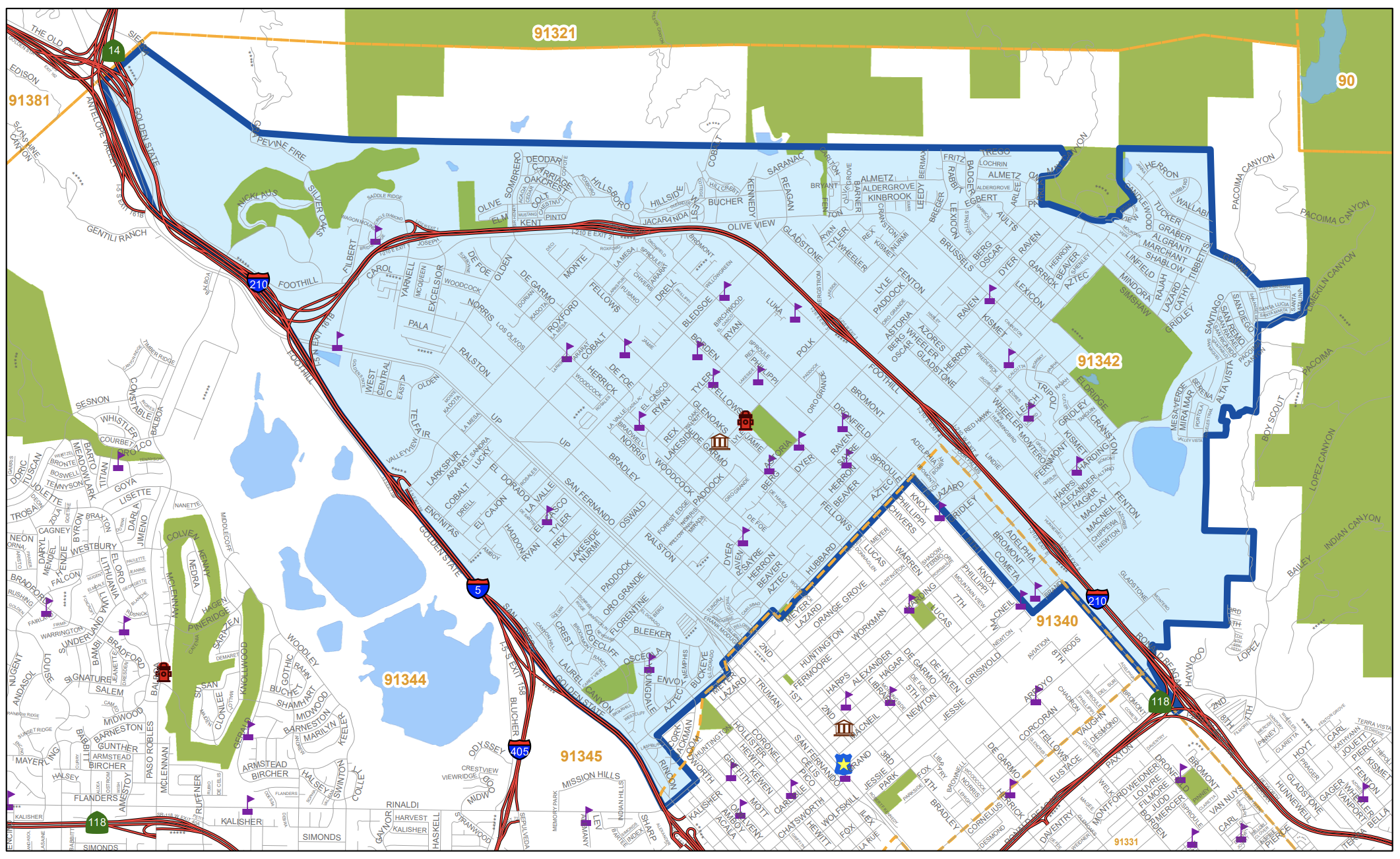
Area Boundaries and Map
View our neighborhood council boundaries for which we deal with.

EMPOWER LA

NEIGHBORHOOD COUNCIL CALENDAR & EVENTS
The public is invited to attend all meetings.

NEIGHBORHOOD COUNCIL FUNDING SYSTEM DASHBOARD

SUBSCRIBE TO NC MEETING NOTIFICATION

Los Angeles Open Data Portal
© 2026 Sylmar Neighborhood Council.